About the Calendar
This year's calendar is a celebration of the wonderful sites and views that we get to enjoy within our country. Distributed over 12 months, we hope that these images will bring out awe, excitement and curiosity in you to seek out the spectacular in life. We wish you an inspired year ahead.
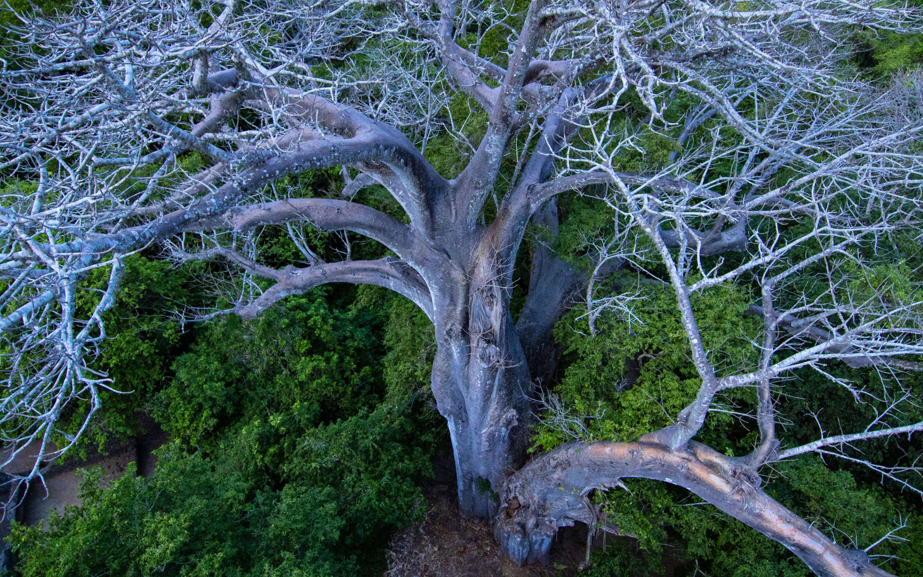
The Great Baobab Tree of Mnarani | Location: Kilifi
This area holds great cultural and spiritual significance to many communities and religious groups in the area. This ancient tree is as much a place of worship as any other, open to anyone who needed it from the days of our ancestors to date. In the past, people would gather under the large canopy, place their prayers, sacrifices and offerings in the hollow of the trunk, walk around its circumference seven times and pray to their God to intercede in all their areas of need.
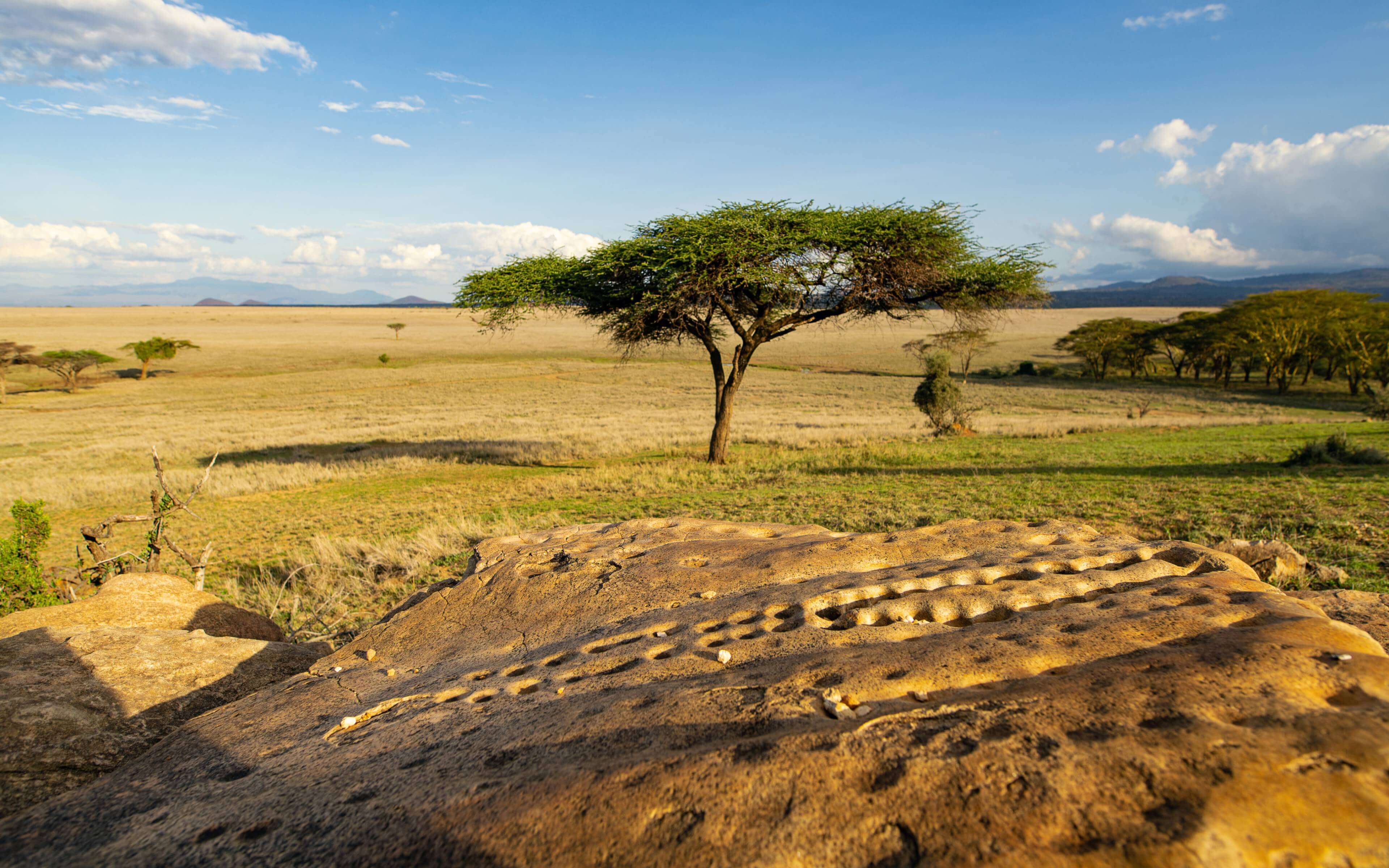
Gong Rocks of Lewa | Location: Lewa Wildlife Conservancy
On the face of it the Rock Gongs are just rocks with strange cuplike depressions and random etchings. They are located in a remarkably scenic spot but rocks all the same. But don’t judge a book by its cover. The Rock Gongs are an incredible piece of history and a window into the early days of man. If Kenya is indeed the cradle of man then these gongs are a crucial part of the body of evidence in support of that position. The rocks are not just a sight, when struck with a hammer they produce a musical tone. The Samburu believe their ancestors are responsible for the design and sound of the rocks. In fact, the Gongs are one of their strongest connections to their forefathers and for this reason the community reveres the site. They community believes that their ancestors spent their most important moments at this site, moments of thanksgiving and communal celebration that were naturally preceded by sacrifice and prayer. Even during times of strife within the communities, this place remained peaceful. This explains why for generations the community has used this spot as a waystation and a meeting point, because at this timeless place, they feel a strong connection to their past, their culture and possibly their future.
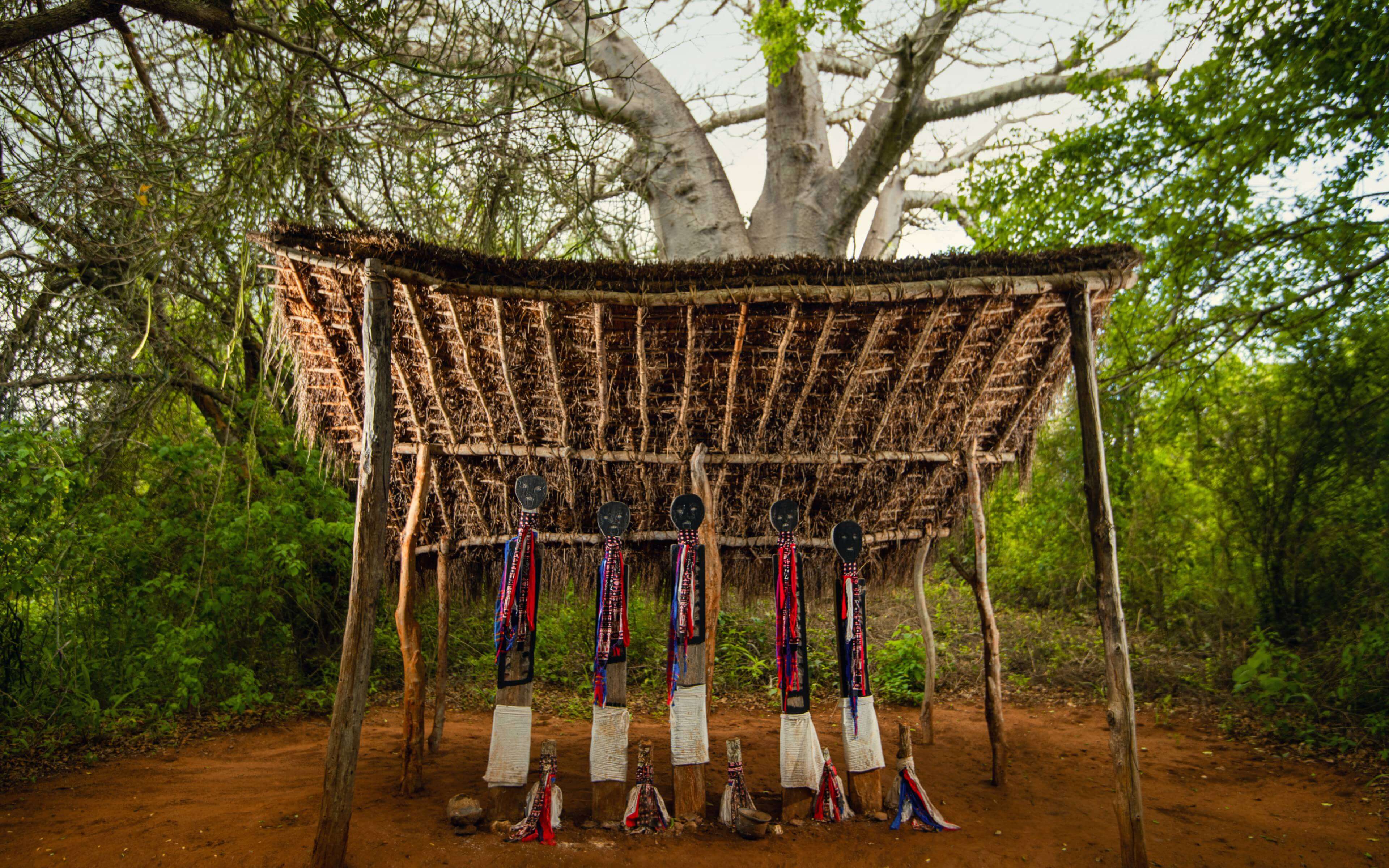
Vigango Shrine of Kaya Kauma Forest | Location: Kilifi
Every community has a story, and at the heart of this story is something that connects all members of the tribe past and present. For the Mijikenda, the Sacred Kaya Forests provide this connection. Kaya is the Mijikenda word for village. The Kaya Forests are 10 separate forests covering an area of about 200km that have grown over the remains of fortified villages, built to protect the community during times of war that have been abandoned since the start of the 20th century. The villages were designed to protect the community from marauders, with the people living in a central clearing surrounded by forest cover. Important cultural artifacts were buried in a secret spot in the clearing to repel invaders. The Mijikenda consider the Forests as the home of their ancestors and a focal point of their culture and identity. A council of Elders looks after the forests on behalf of the community. The Forests are considered sacred ground. No children are allowed and even adults must dress appropriately, in a kanga, to access the site and visitors cannot set foot on these sacred grounds with shoes on or have any artificial smells on them. The community believes the spirits of their ancestors are alive and visitors come with sacrifices to curry their favour. The site is the community’s most sacred location. This is where the community’s prayers are offered by the Mulombi, primarily for rain before planting season and in thanksgiving after harvest. Prayers are also offered during times of war and disease. (During Covid 19-the Mulombi offered prayers.) When praying, the community comes to the site with a chicken and a goat to offer to the ancestors. The chicken is not slaughtered but thrown against a rock and thrown into the River Nzovuni that flows from the forests all the way to the sea. If the chicken is carried away the prayers are considered successful, if it does not the prayers are deemed unsuccessful.
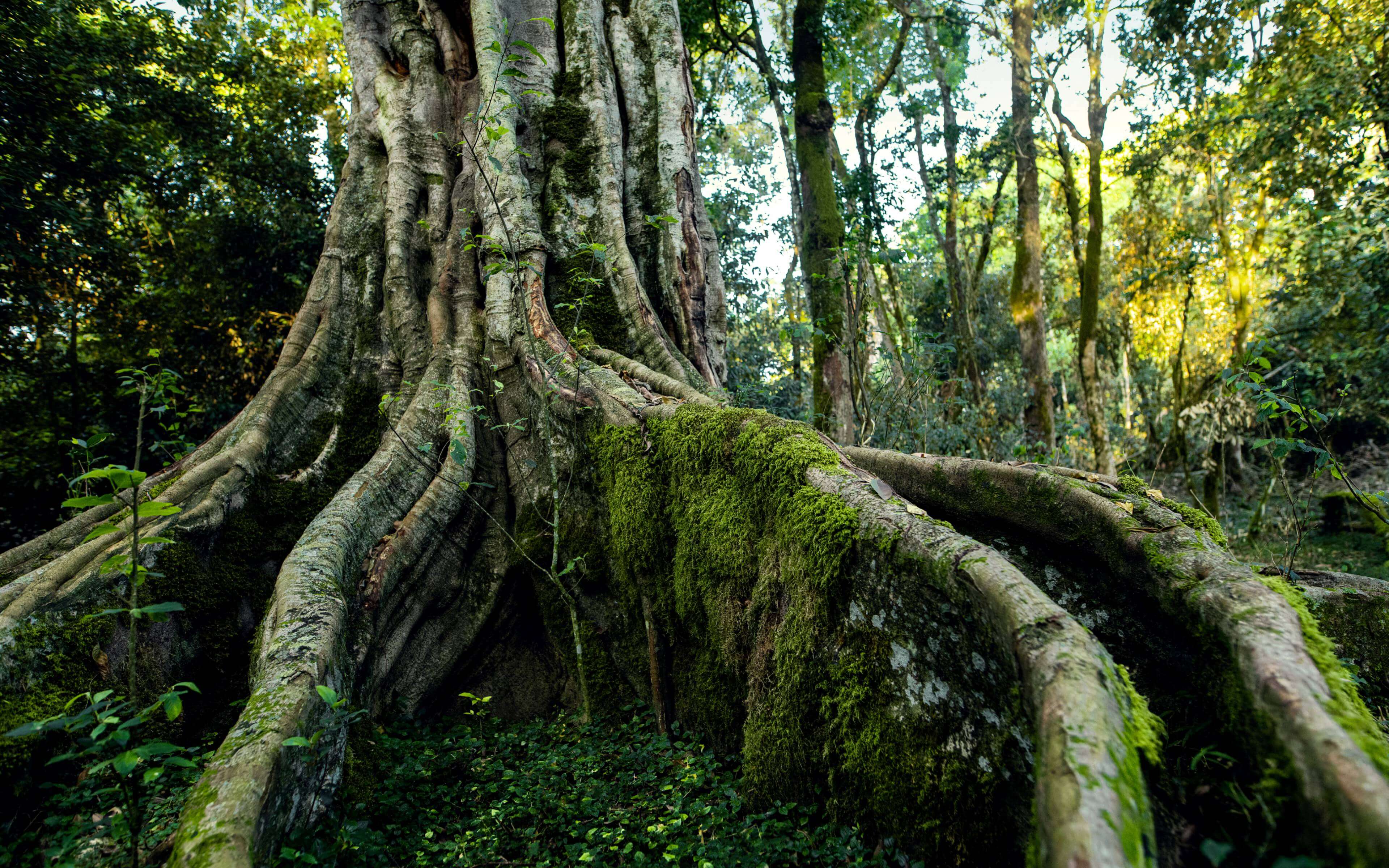
Oreteti Tree | Location: Maasai Mara
The Masai are world famous for many aspects of their culture; their resplendent shukas, their bravery, their dancing and their jewelry. However, little is known or spoken about the spirituality of the community which explains why the Oreteti tree is not quite well known. The Maasai have a collection of plants that they use for medicinal and nutritional purposes but the Oreteti is the only one that is considered sacred- the home Enkai, the creator. The Oreteti has been the center of Masai rituals for generations, every spiritual ceremony in the community is solemnized around the Oreteti. When young men are sent to the forest for their initiation, their ascendancy to manhood is formalized and blessed by the elders under the Oreteti. During times of drought, the rain makers said their prayers under the Oreteti. When a woman fails to conceive, the fertility ceremony times is performed at the Oreteti.. The ceremony involves tying the vines of the tree around the woman’s waist, drinking the juice of boiled vines and walking around the tree seven times.
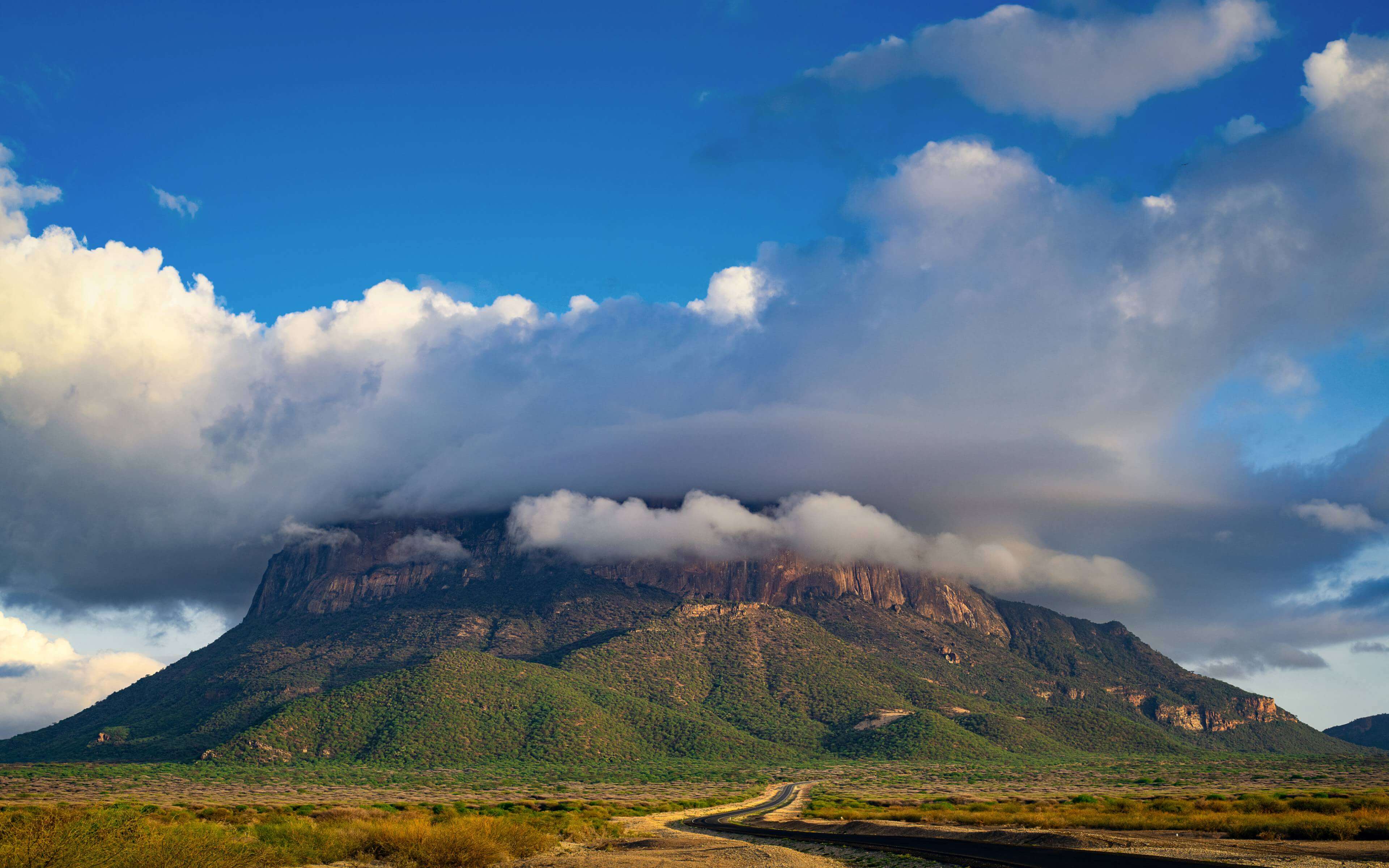
Mount Ololokwe | Location: Marsabit
It almost looks out of place, but it also looks perfect sitting as it does right in the middle of the stunning Samburu landscape, rising up as if to converse with the gorgeous blue skies. Visible from tens of kilometers away and a sight to behold with its table like appearance, this is Ololokwe the sacred mountain of the Samburu. For generations the Samburu have roamed the rolling plains around and beneath the mountain tending to their livestock. The Samburu revere Ololokwe because they consider it the source of water and food for their livestock. In times of hardship and droughts the Samburu have turned to the mountain to plead for a return to normalcy and prosperity. The elder women of the community would go up to the mountain and pour milk as a sacrifice in prayer for their needs to be met by God.
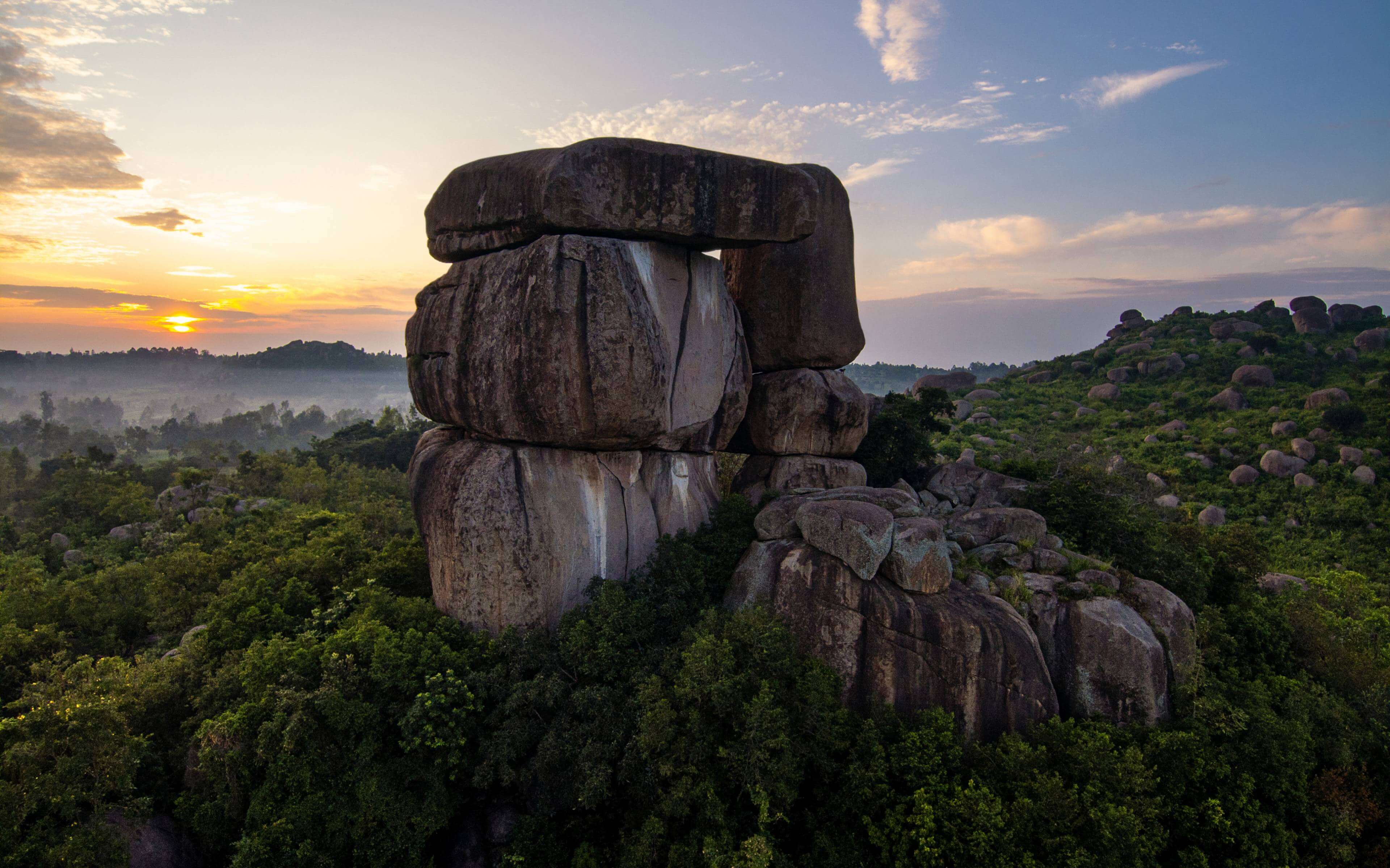
Kit Mikayi | Location: Kisumu
Breathtaking. There is no other way to describe this unique rock formation, rising 120 metres into the sky, 30km west of Kisumu. Kit Mikayi in dholuo means stone of the first wife and the name is derived from the legend of Ngeso. The story goes that Ngeso was a local man with a deep affection for the stone, he would leave his home and spend hours in its cave. His wife was forced to bring him his meals there. And when she would walk around the village, if anyone asked about her husband’s whereabouts, she would nonchalantly reply that he was with his first wife-the stone. Legend has it during a severe drought the elders went to the seers to ask what they needed to do to bring rain and they were told to go and offer sacrifice at Kit Mikayi and from that moment the community has treated the rock as a prayer site. Elders offer a white goat and four chicken, which are slaughtered, roasted and first offered to the ancestors through a crevice in the rock. The community then prays together and shares the rest of the meat. For the prayers to be successful, they had to be led by a local and offered facing
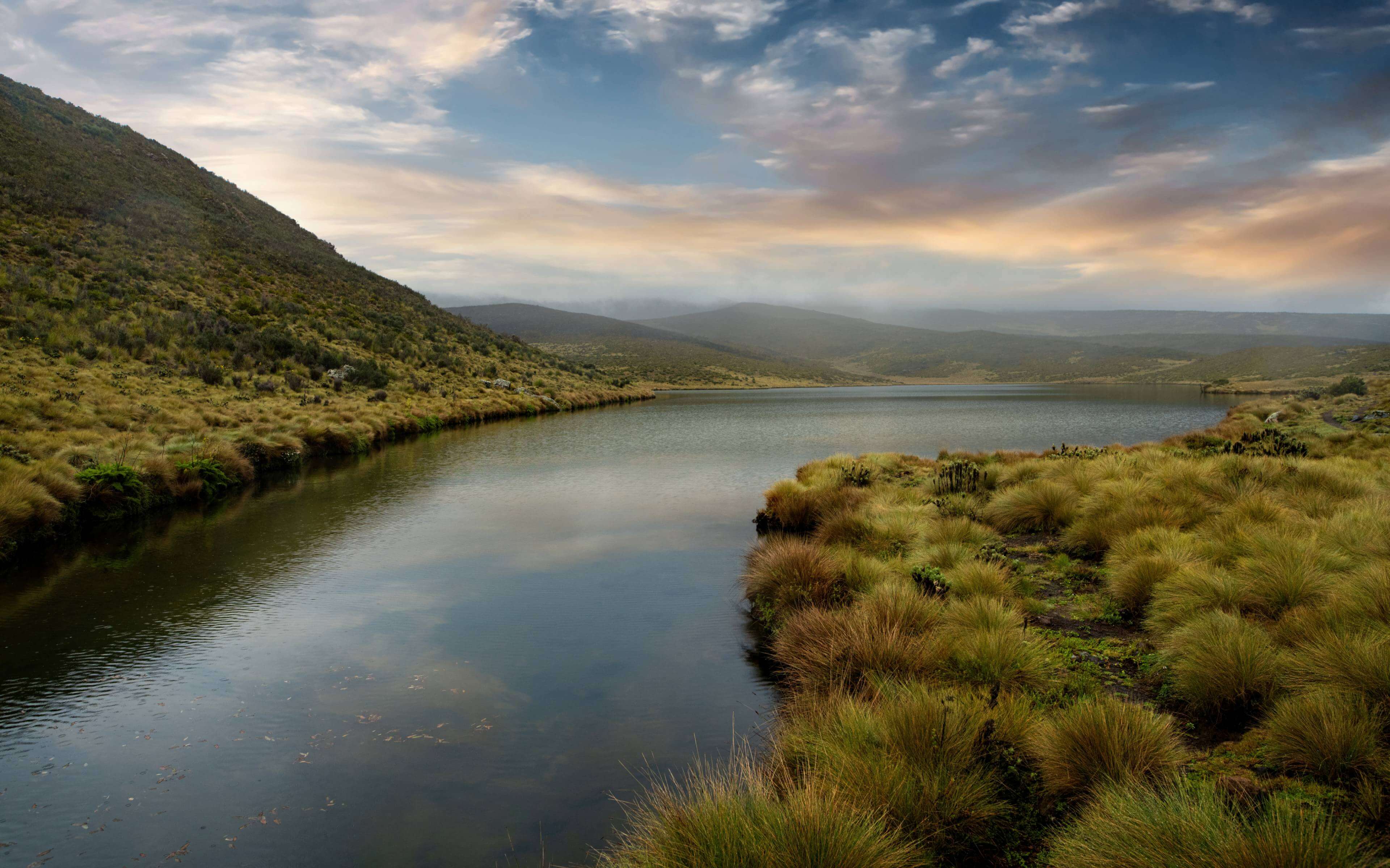
Iria Ria Kijiariro (Lake Ellis) | Location: Mt. Kenya
28 acres of Aqua blue wonder nestled in the lush green landscapes around Mount Kenya. It is a thing of true natural beauty, a genuine treat for the eyes, a serene spot to start the soul and reset the mind. Lake Ellis is one of mount Kenya’s best kept secrets hiding just above 3000 feet above sea level. The locals call it Iria ria Ijairiro, Lake of Birth, because most animals living in the forest come to the lake to give birth. Mt Kenya has always had spiritual and cultural significance for the Kikuyu and other communities that live at the base of the mountain. In times of drought, and any communal affliction the elders would slaughter a goat to appease the gods and throw its intestines into the lake in hope of rain and prosperity. The Lake was considered sacred and only elders were allowed to set foot at the site. The prayers and sacrifices offered at this lake were a measure of last resort, after everything else had been tried and failed. For years the community has believed that throwing a stone in the lake would lead to rain, a belief that is still alive to this day. The Lake is a product of glacial activity almost over 10,000 years ago and is named after Thomas Evelyn Scott-Ellis the first explorer to reach the site in 1927.
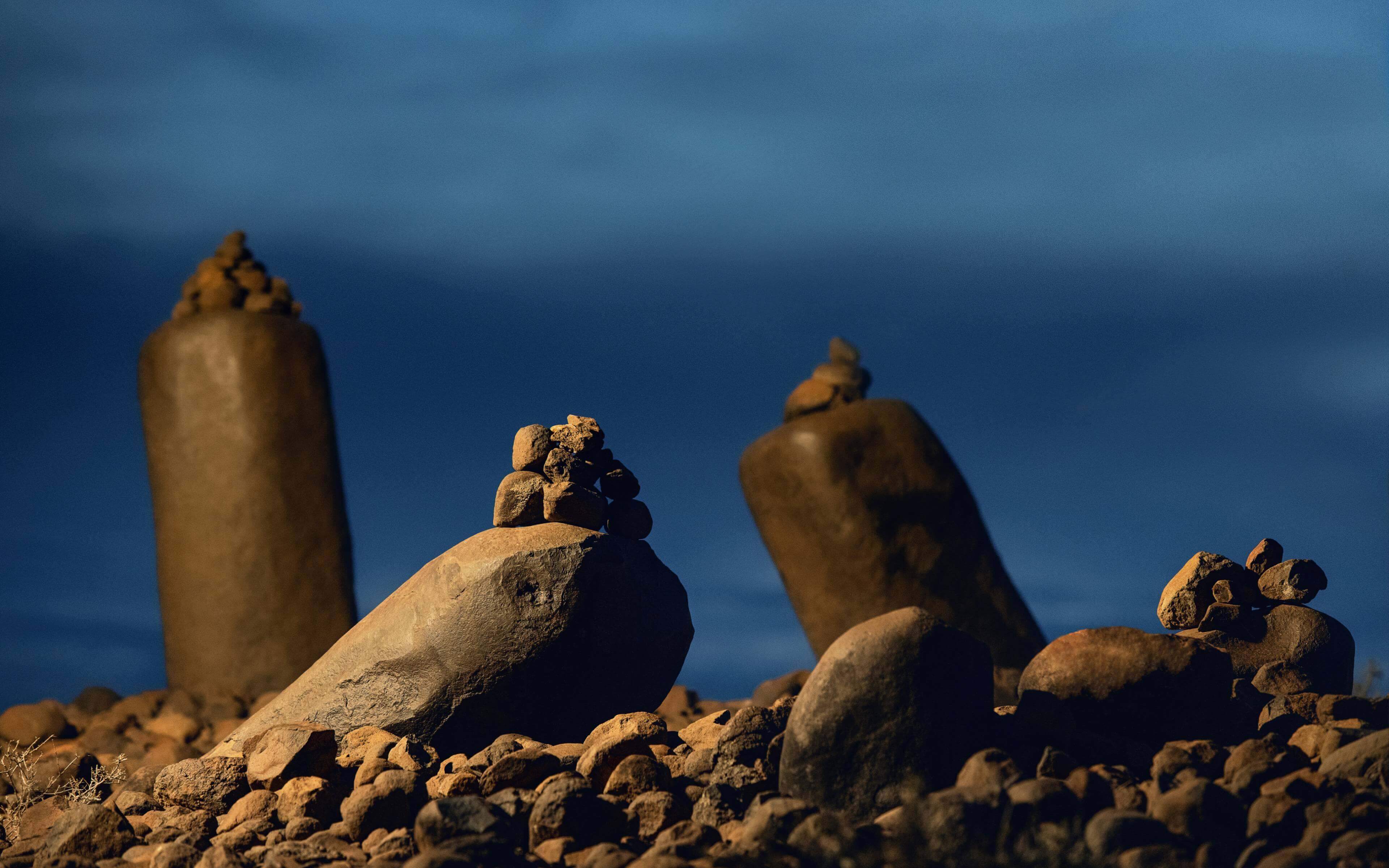
Namoratunga Stones | Location: Turkana
Namoratunga, 50km west of Lake Turkana, makes you stop and think. And why wouldn’t you? 19 stone pillars, deliberately arranged in a council like formation but each leaning at their own distinct angle, and beneath them a base of about 20,000 small stones. Who arranged these pillars like this? And why? Welcome to the mystery of Namoratunga which in Turkana translates to ‘people of the stone. Legend goes the Turkana people were a lively community, often holding Dong’aa -communal celebrations marked by feasting, singing and dancing. One day the community welcomed a stranger to sing and dance with them, he accepted but, on the condition, that no one could laugh at how he sung and dance. Those who laughed were turned into stone the instant they did. The locals believe only a god can wield such power and that the visit was a call to recognize and acknowledge the significance of the deity. From that moment on the site became sacred ground for every Turkana. This is their shrine. This is the home of their deity. The community has come the site in moments of strife, drought and disaster to seek god’s intervention. No Turkana can pass Namoratunga without stopping to show their respect, by adding a stone to the site. The Turkana believe god is for all and welcome visitors but they too have to add a stone to the site.
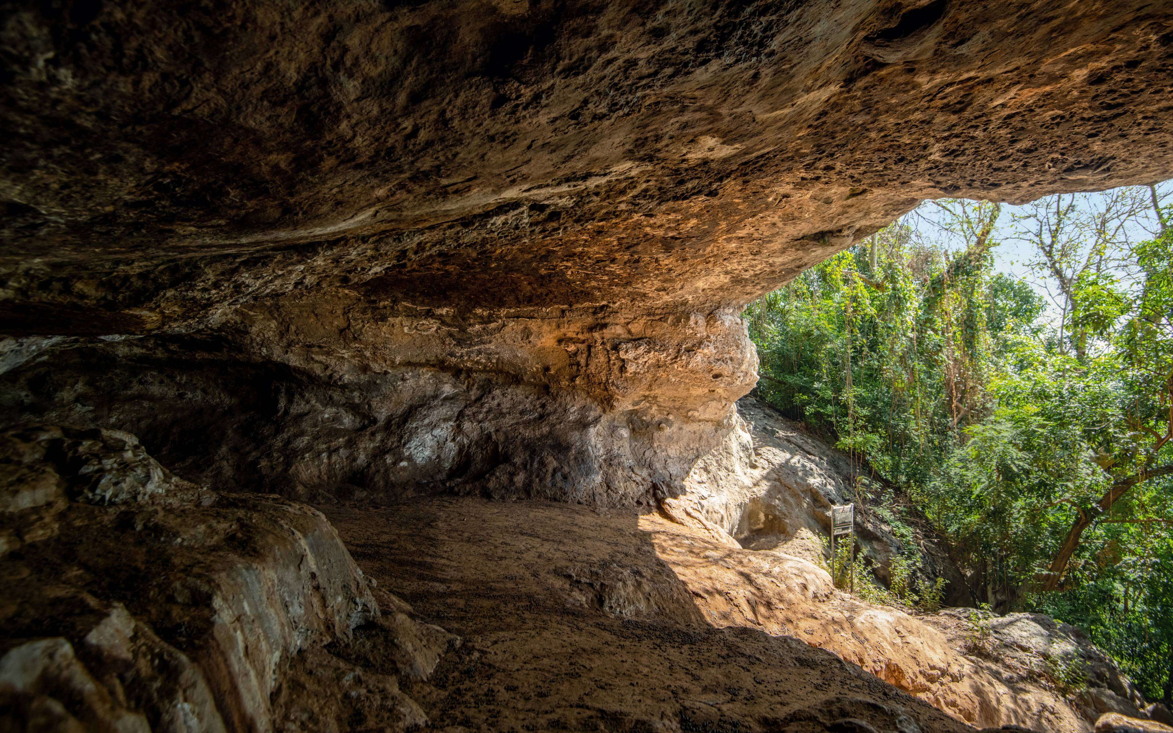
Sacred Caves of Mfangano Island | Location: Homa Bay
If you asked the Abasuba people what Mfangano Island means to them the response would be swift and decisive-everything. Mfangano Island is not just where the Abasuba first settled after years of war and eviction; it is the physical location of their most sacred sites. These caves called Kibaga in the local dialect are according to the Abasuba are their only link to God. Originally there were 36 caves but 17 are extinct and only 19 can identified. The caves are the main worship sites for the community and sacrifices were offered from the top of the caves. Mfangano is world famous for its rock art but for the community the drawings on the rock hold deep spiritual significance. The art in red ochre signifies the moon and the ones in white ochre represent the sun. When the community prays for rain, they do it facing the art representing the moon, and when they pray before the sun, they are sending drought and calamity to their enemies. The caves were also used to induct young men and women into adulthood, they would be taken up into the caves by the elders to be taught the ways and values of the community.
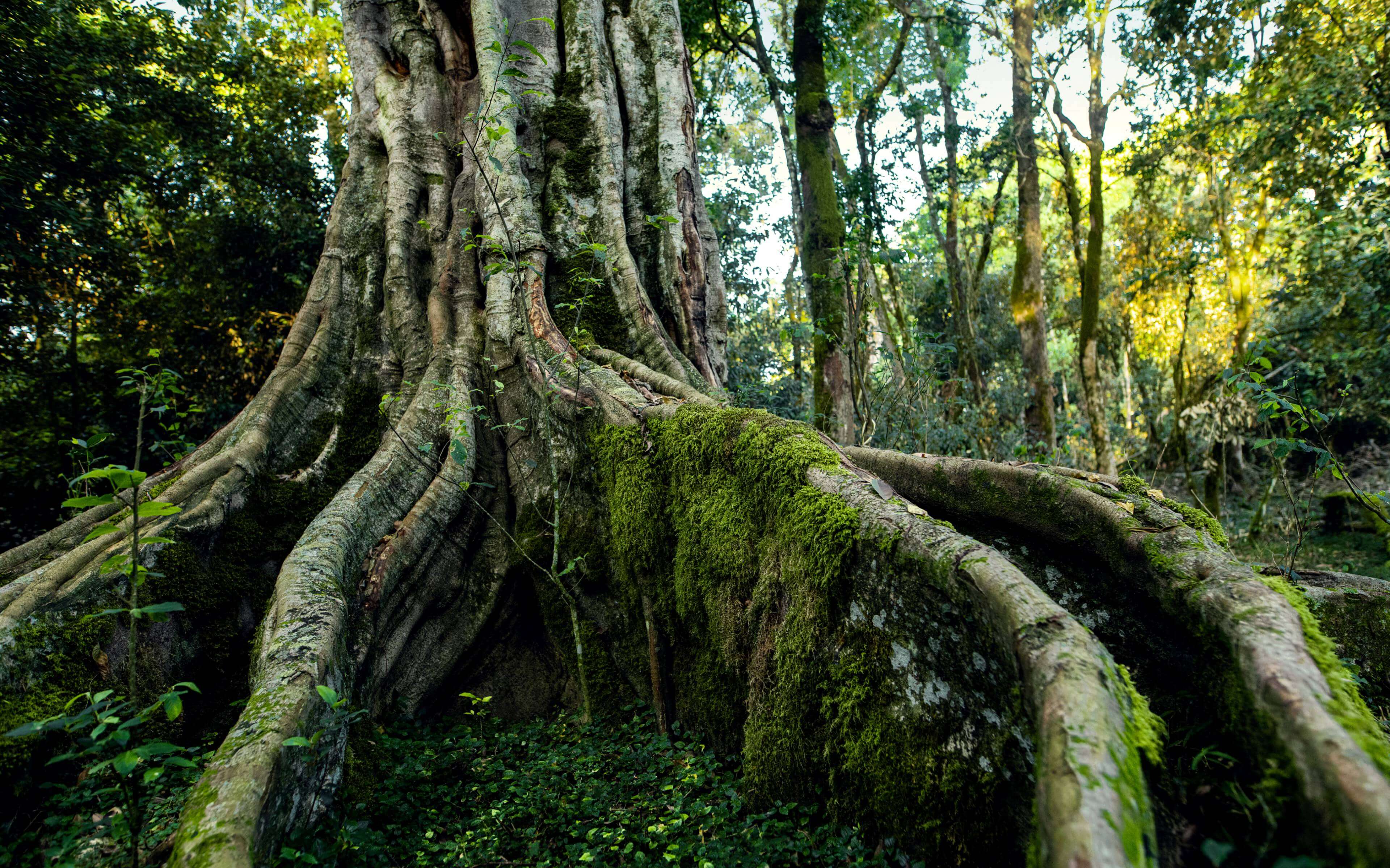
Mugumo Tree | Location: The Aberdares Forest
The Mugumo tree has an obvious majesty, a presence that is impossible for the senses to miss, a dominance that dwarfs the viewer and effortlessly elicits awe. Reaching an imposing 90 meters its physical reach is only outdone by its by spiritual and cultural significance to the Agikuyu community.! For the Kikuyu the Mugumo tree and the ground beneath and around it is a site of reverence- the dwelling of Ngai the creator. It is a shrine, a sanctuary, a cultural center and a place of reflection supplication and rejuvenation. Children are warned from an early age to stay away from the site. Failure to heed this, the young ones were told could lead to a reversal of gender! The Kikuyu came to the Mugumo to give thanks in good times and plead for prosperity in lean times and when war broke out the community-built rafts and hid in the branches, avoiding death. During the colonial times, the community used the bark of the tree to send messages-the community’s version of a post office. This particular Mugumo tree faces Mt Kenya, the home of Ngai and elders of the community have to come this site to hold various rituals for generations, slaughtering goats and offering sacrifices to Ngai. Even to this day the elders still hold periodical cleansing prayers at the site. When a vine drops from the tree, the community believe that is a sign one of their elders will be ‘called’ to go to Ngai. Despite converting to Christianity, the Mugumo tree is still held in special esteem by the Kikuyu community and is never cut down unless it is absolutely necessary.
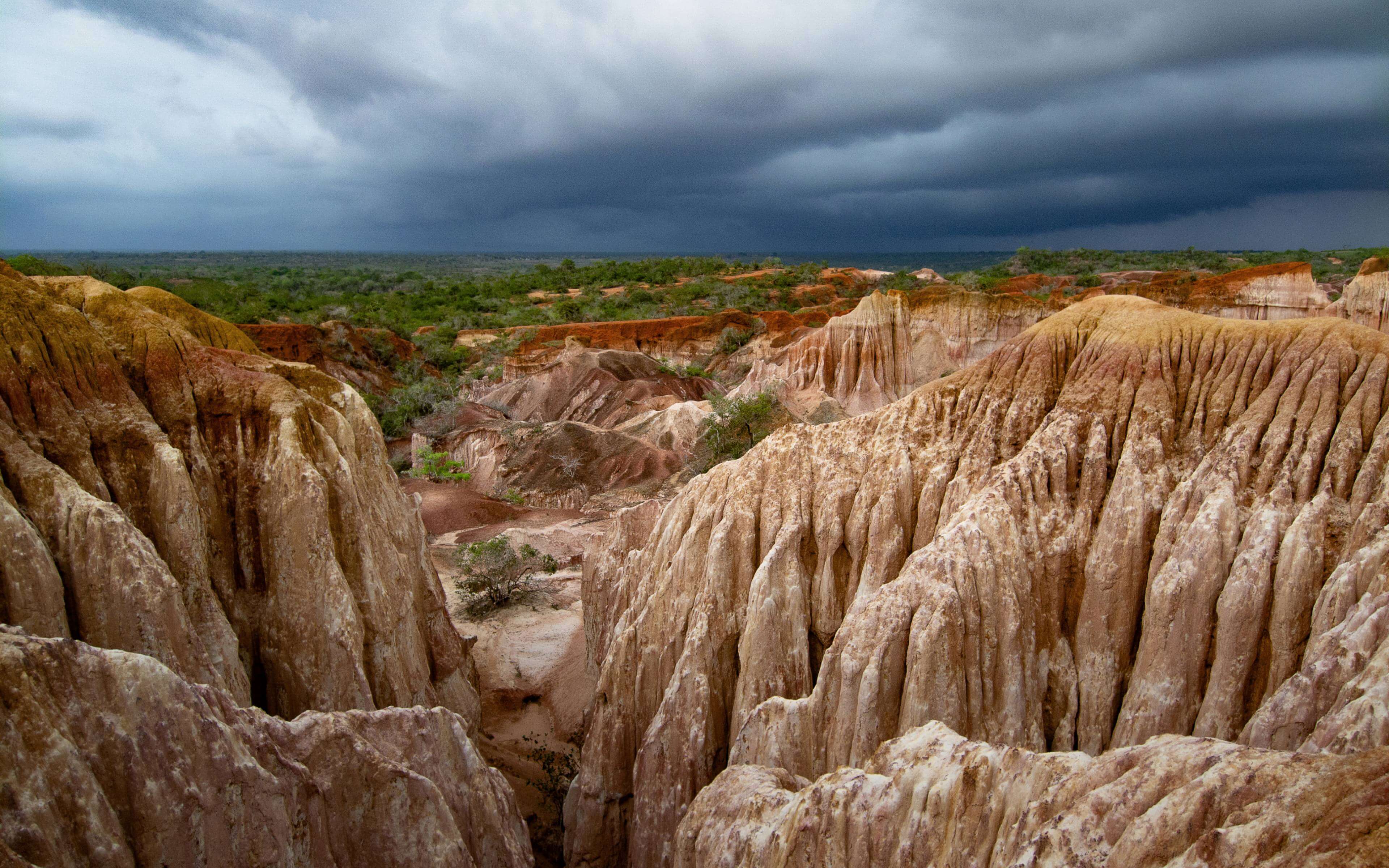
Nyari (Hellʼs Kitchen) | Location: Marafa Settlement
It’s ironic that a place of prayer would carry the name Hell’s Kitchen but the name is a reference to temperature-which rises to about 50 degrees Celsius-and nothing to do with the spiritual. The site itself is a visual wonder, a multi-color canyon that changes tint depending on the angle of the light. There are two origin stories for this place called Nyari which means place of worship in the local language. The first is that the physical depression was formed by time, rain and wind. The second one is the story that goes back hundreds. There used to be a settlement of the Wada community on site. The community kept a lot of animals especially goats, sheep and cattle. These animals produced so much milk that the residents used to bathe in milk. This annoyed the gods who crushed the entire settlement and sunk it into the ground. The red hue of the canyon is the blood of those who sunk and the white hue is the milk. The Kaya community consider this a holy site and pray here twice in a year. On the first occasion they come to offer sacrifices for a bountiful harvest and then they return 9 months later with sacrifices of thanksgiving.
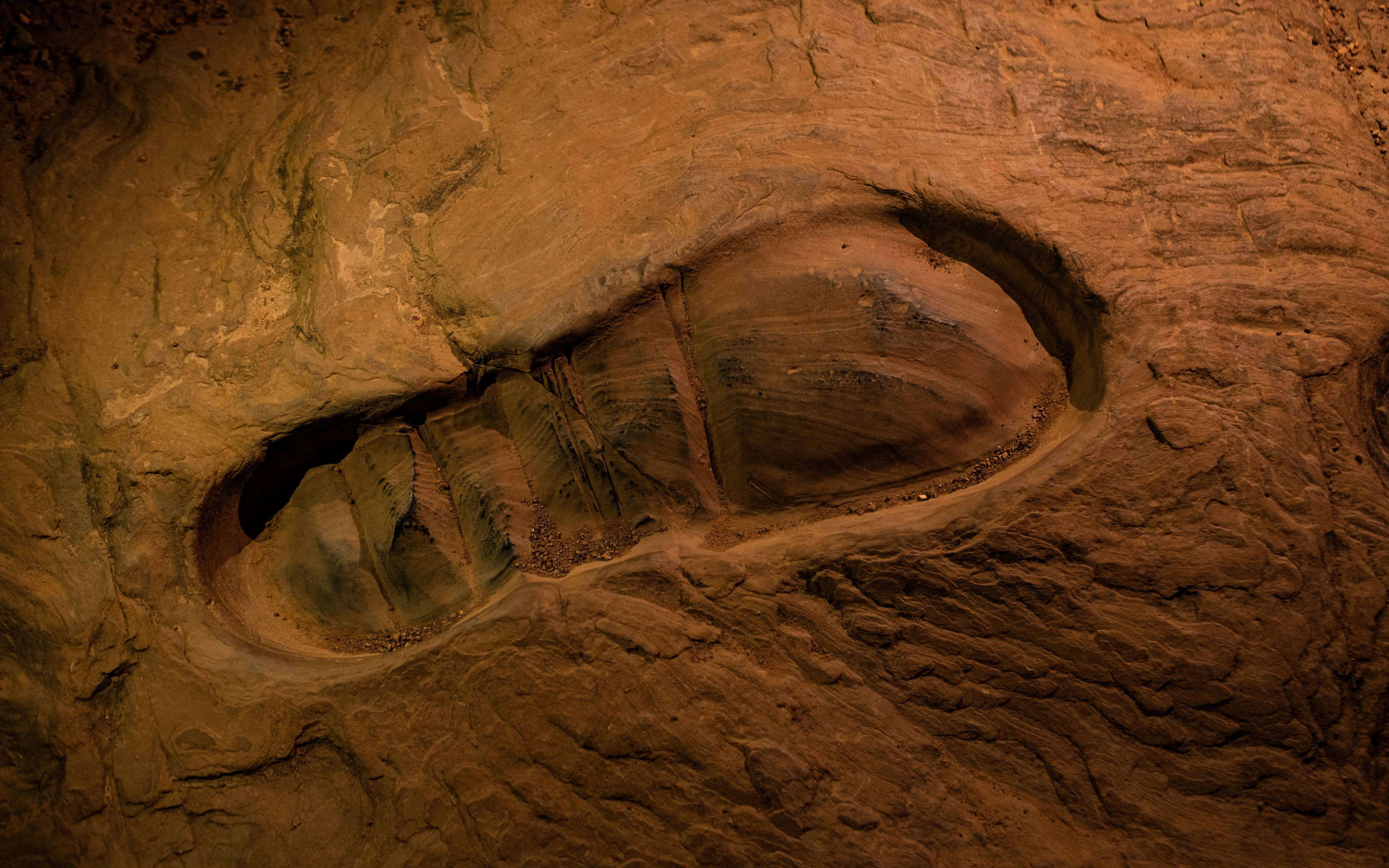
Lwayo Lwa Mulungu (Godʼs Footprint) | Location: Kwale
For thousands of years human beings across many civilizations have tried to work out how God looks like. A small village in Kwale County claims to have a partial answer-God visited and left behind his footprints on a rock. Lwayo LwaMulungu, which translates to the footprint of God is located 5 Kilometeres from Lunga Lunga town. There are two footprints are each 18 inches long. The Duruma,who are the native people of the area say the footprints are too big to be human, and therefore the only explanation is they must be God’s. And for generations the community has held the site and the specific rock the foot print is on to be sacred and no children are allowed on site and young men had to reach adulthood to be taught about the site and its importance to the community. During drought elders would come to the site to pray, offer sacrifices and before they got home the rain would have arrived. The site was also the site for serious conversations and discussions about the community and its culture and practices. The site used to have a tree with a beehive and anyone who arrived at the site with bad intentions was swiftly pounced upon and stung. A white man once arrived at the site with his two sons to try and take away the footprint- he fainted on site. Community sacrifices have diminished at the site but the site still attracts pilgrims from far and wide.